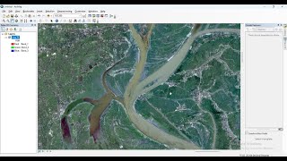
Mosaic Sentinel-2 images in the ArcGIS Pro

Mosaicking is the process of combining multiple satellite images into a single, seamless image. This technique is commonly used in remote sensing to create largescale maps and monitor changes in the Earth's surface over time. By mosaicking Sentinel 2 images, we can create highresolution maps that show detailed information about land cover, vegetation health, and other important environmental factors. These maps can be used for a variety of applications, including agricultural monitoring, urban planning, and disaster response.
__ __ __ __ __ __ __ __ __ __
in this video we've shown you how to Mosaic sentinel 2 images in ArcGIS Pro in the fastest way.
__________
Check it out:
Like & Share the video with others:
✅ • Mosaic Sentinel2 images in the ArcGI...
_ _ _ _ _ _ _ _ _ _ _ _ _ _ _ _ _ _ _ _ _ _
Subscribe to our channel :
✅ / @rsgis6997
=========================================================
#GIS #gistutorial #arcgis_pro #arcgispro #sentinel2 #Mosaic