Multiple Criteria Overlay Analysis Using QGIS (Vector Data)

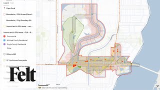
Welcome to our YouTube tutorial on "Multiple Criteria Overlay Analysis Using QGIS." In this tutorial, we will guide you through the process of selecting optimal areas for building new parking facilities in the Westminster borough of London. We will leverage the power of QGIS and geoprocessing techniques to make datadriven decisions that can help reduce bicycle thefts in the area.
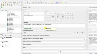
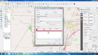
In this tutorial, you'll learn how to perform multicriteria overlay analysis, a powerful spatial analysis method that considers various location attributes. We will be working with several datasets, including shapefiles for cycle routes and parking facilities provided by Transport for London, a heatmap of cycling thefts generated from police data, and the Westminster boundary.
Data can downloaded from this link also:
https://drive.google.com/drive/folder...
Datasets Source:
• Cycle Routes and Parking facilities: Shapefiles for the Westminster borough, London. Provided by Transport for London.
• Cycling Thefts Heatmap: Generated from Bicycle Theft Point locations for 2019 provided by data.police.uk.
• Westminster boundary: Extracted from London Boroughs layer from Statistical GIS Boundary Files for London.
QGIS Version: 3.32.1Lima
This video is an adaptation of a tutorial originally created by Ujaval Gandhi at Spatial Thoughts (https://spatialthoughts.com/).


![[QGIS APPLICATION] Multiple Criteria Decision Making For Selection of Suitable Agricultural Land](https://i.ytimg.com/vi/TDwg8Wi5rYs/mqdefault.jpg)