It was never so easy to get YouTube subscribers

Natural Earth Data: Mapping the Earth with Public Domain GIS Data

https://gisgeography.com/naturaleart...
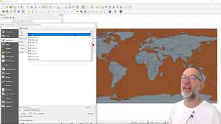
Natural Earth data is a public domain dataset that provides a wide range of geospatial information about the Earth's physical features, including landforms, oceans, lakes, rivers, reefs, glaciated areas, and much more. But it also includes boundaries for countries, states, and provinces, as well as populated places, transportation networks, and even time zones.
The dataset covers the entire globe, providing globalscale data with consistent quality and accuracy. One of the key advantages of Natural Earth data is its level of detail as it offers multiple scales, ranging from global to regional and local.


Recommended