Get free YouTube views, likes and subscribers

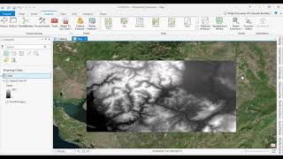
ortho and reality mapping with Drone images in ArcGIS PRO

I will show you how to generate high resolution DSMs, orthophotos, dense point clouds and photo realistic 3D elevation models in ArcGIS PRO.


![The moment we stopped understanding AI [AlexNet]](https://i.ytimg.com/vi/UZDiGooFs54/mqdefault.jpg)


Recommended