Secret weapon how to promote your YouTube channel

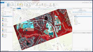
Pansharpening in ArcGIS Pro

https://gisgeography.com/pansharpening/
Pansharpening is an image processing technique that enhances the spatial resolution of an image.
By fusing a highresolution black and white panchromatic image with lowerresolution color imagery, you can achieve a much sharper output image.
In this tutorial, I am going to use Landsat imagery and show you how to use pansharpening in ArcGISPro.


Recommended