15 YouTube views, likes subscribers in 10 minutes. Free!

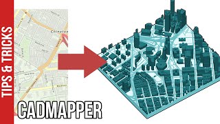
PART 1 - How to create 3D BUILDING MAP VIEW in QGIS using Qgis2threejs PLUGIN

Create your UD analysis diagram of 3D city buildings easily using Qgis2threejs plugin in QGIS.
The figure ground dataset used in the video is from AURIN https://aurin.org.au/. This site is only available to organisations (this includes universities) in Australia.
You can use Open Street Map as alternative if you don't have access to AURIN or are not in Australia.
To get the figure ground data from AURIN, see my video: • How to create base map in AUTOCAD usi...
See part 2 of this series here: • PART 2 How to create 3D BUILDING VI...


Recommended