✅ PHANTOM 4 MULTIESPECTRAL PHENOMENAL PRECISION AGRICULTURE 🚁

:
/ cursosonlinegis102293867855318
SUBSCRIBE TO YOUTUBE CHANNEL: https://bit.ly/2yC6H35'>https://bit.ly/2yC6H35
PHANTOM 4 MULTIESPECTRAL PRECISION AGRICULTURE
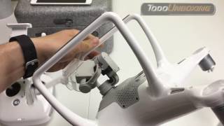
PHANTOM 4 WITH MULTIESPECTRAL CAMERA FOR PRECISION AGRICULTURE
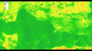
The P4 Multispectral (PHANTOM 4 MULTIESPECTRAL AGRICULTURA DE PRECISION) consolidates the data capture process that provides information on crop health and vegetation management. DJI has created this platform with the same powerful performance standards that DJI is known for, including a maximum flight time of 27 minutes and a transmission range of up to 7 km 1 with the OcuSync system.
If you are interested in how to do the above, stay until the end, subscribe if you have not done so, share with your friends and activate the bell to notify you every time we publish a new video.
Leave your comments on the video, subscribe if you have not done so, like and share among your friends so that many are part of this community and remember: Who has the knowledge is free!
✅ SUBSCRIBE TO THE CHANNEL: https://bit.ly/2yC6H35'>https://bit.ly/2yC6H35
⭐ VISIT FOR WEB COURSES: https://cursosonlinegis.com/
⛳ MORE INFORMATION: https://cursosonlinegis.com/cursos/
You can also visit coursesonlinegis.com and write to [email protected], [email protected]
tags:
DJI, DJI drones, drone with camera, drone, Aerial Photography, Aerial Photography Drones, Unmanned Aerial Vehicle, UAV, aerial photography drones, aerial videography, uav drones, precision agriculture, precision agriculture with drones, phantom 4 agriculture, phantom 4 multispectral, Phantom 4 for precision agriculture, DJI multispectral camera, DJI phantom 4 sensors, agriculture drone, agriculture courses, ONLINE GIS COURSES, phantom 4 agriculture, phantom 4 multispectral, phantom 4 agricultural camera