Prepare your groundwater project in QGIS

In this tutorial you'll learn how to prepare a groundwater project in QGIS. You'll learn how to reproject data, defining a study area with a buffer. You'll learn how to use vector geoprocessing tools such as clip, dissolve and intersect. In the end you'll save your whole project to one GeoPackage.
This tutorial has been developed by IHE Delft for the SADC Groundwater Management Institute (SADCGMI) in cooperation with IGRAC. It has been recorded during the first live online session of the GIS training for Hydrogeolical Applications.
The step by step tuturial is available at IHE Delft OpenCourseWare: https://ocw.unihe.org/course/view.ph...
#QGISHydro #IHEDelft #IGRAC
0:00 Introduction
0:46 Reproject layers
2:09 Copy styles
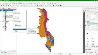
4:32 Define a study area
15:30 Clip layers to boundary
20:30 Save project to GeoPackage
23:13 Sample hydrogeology at wells
27:30 Join attributes
29:38 Copy attributes