Grow your YouTube views, likes and subscribers for free

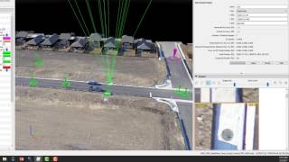
Processing Drone Images with GCPs using Pix4D Mapper

This is a video tutorial on how to process drone images to make accurate map products using Pix4D Mapper software.
[Updated on 16/11/2021] The sample data set used in this video can be found in :
https://drive.google.com/drive/folder...


Recommended