15 Free YouTube subscribers for your channel

Project GIS Mesh back to Sphere with Geometry Nodes on Blender

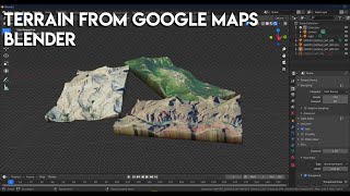
As we know, the earth is round but maps are flat.
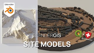
The popular BlenderGIS addon lets you import GIS cartographic data into Blender. This data can be preprocessed in geographic software such as QGIS.
Learn how to project this meshes back onto a sphere using Blender's powerful geometry nodes. This visual programming environment allows us to set sine and cosine formulas to automate this process on different geometries. This lets you create visuals with terrestrials globes, as we also look at how to project a texture such as an orthophoto onto these objects.
Link to the dataset : https://public.opendatasoft.com/explo...
Useful links to set XYZ Tiles in QGIS : https://github.com/roblabs/xyzraster...


Recommended


