Get free YouTube views, likes and subscribers

QGIS Raster Interpolation

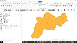
In this video we use interpolation application to create new raster layers from vector layers. We'll create a DEM from 5m contour lines and a groundwater quality raster from borehole data.
Timestamps
1:10 Open project
2:17 Add 5m contours
3:19 Processing tools
4:05 TIN Interpolation
06:45 Styling the DEM
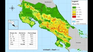
11:34 Slope Analysis
12:55 Slopes as degree of inclination
13:24 Calculate slopes of 1:5
15:00 Identifying slopes with the Raster Calculator
17:43 Converting a raster to a polygon
20:26 Hillshade
22:46 IDW Interpolation
26:40 Styling the Electrical Conductivity raster
QGIS https://qgis.org
Spatial Modelling Solutions http://www.smsgis.co.za


![[QGIS] CONVERT POINT/POLYGON TO RASTER | CREATE TIN | IDW INTERPOLATION | RASTER TO CONTOUR IN QGIS](https://i.ytimg.com/vi/qPM8GgAPznQ/mqdefault.jpg)


Recommended