QGIS Tutorials 11: Importing GPS Data u0026 Convert to Shapefile using QGIS | QGIS Beginners | GPX file

This is a special video tutorial series for absolute beginners in QGIS. In this video you will learn how to import GPS data and convert it to shapefile in QGIS. You can Import GPX file (waypoints, routes and tracks) in QGIS Visualize and save & convert into shapefile.
Video 1: How to Download and Install QGIS in Windows 10 / 11
• QGIS Tutorials 1: Download and Instal...
Video 2: Introduction to QGIS Interface for Absolute Beginners
• QGIS Tutorials 02: Introduction to QG...
Video 3: How to Add Panels and Toolbars in QGIS
• QGIS Tutorials 3: How to Add Panels a...
Video 4: How to Find and Install Plugins in QGIS
• QGIS Tutorials 4: How to Find and Ins...
Video 5: Measure Tool and Identity Tool in QGIS
• QGIS Tutorials 5: How to use Measure ...
Video 6: How to use Pan, Zoomin, Zoomout and Bookmark in QGIS
• QGIS Tutorials 6: Pan, Zoomin, Zoom...
Video 7: How to Add & use Multiple Map Canvases in QGIS
• QGIS Tutorials 7: How to Add & use Mu...
Video 8: Save and Load Project Files in QGIS
• QGIS Tutorials 8: Save and Load Proje...
Video 9: Loading Shapefile in QGIS
• QGIS Tutorials 9: Loading Shapefile i...
Video 10: Loading Raster in QGIS
• QGIS Tutorials 10: Loading Raster lay...
Video 11:Importing GPS Data & Convert to Shapefile
• QGIS Tutorials 11: Importing GPS Data...
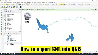
Video 12: How to import a KML into QGIS
• QGIS Tutorials 12: How to import KML ...
#qgis
#qgistutorials
#qgisforbeginners
#qgis3
#gps