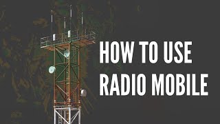
Radio Mobile Tutorial - Create Wireless Coverage Maps

Radio Mobile is a tool that is used to design and simulate wireless radiofrequency (20 MHz 20 GHz) communication systems. It predicts the performance of a terrestrial radio link by calculating link budgets given station RF parameters, distance, terrain, and land cover. Propagation is calculated using the LongleyRice model, also known as the irregular terrain model or ITM. This program could be used to compute coverage for an emergency service, WiFi like wireless ISP, hypothetical radio station, amateur radio repeater, or just about anything else!
INSTALLATION LINKS
Google Earth Pro: https://www.google.com/earth/about/ve...
Radio Mobile: http://www.g3tvu.co.uk/Quick_Start.htm
OTHER LINKS
Unofficial Manual (Very Helpful & Comprehensive): http://radiomobile.pe1mew.nl/
Original Author's Webpage: https://www.ve2dbe.com/english1.html
VIDEO CHAPTERS
0:00 Introduction
0:49 Installation Google Earth Pro
1:29 Installation Radio Mobile
2:46 Setting the Terrain Model & Land Cover
3:27 Creating a New File; Networks, Systems, Units
4:18 Creating a Map
5:56 Creating a Network
6:49 Creating Systems
8:18 Creating Units
9:29 Assigning Units to Systems
10:21 Creating a Coverage Plot
12:58 Creating a More Detailed Coverage Plot
14:45 Export to Image and Google Earth KML
15:29 Viewing Maps in Google Earth Pro
16:18 PointtoPoint Link Analysis
17:55 Conclusion
Most of the royaltyfree pictures in this video can be found here: https://pixabay.com/collections/radio...