Grow your YouTube views, likes and subscribers for free

Radiometric calibration using remote sensing GIS software ENVI

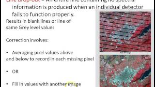
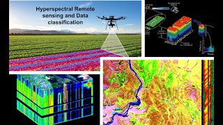
Radiometric correction and atmospheric correction are done to calibrate the pixel values and correct for errors in the values. The process improves the interpretability and quality of remote sensed data. Radiometric calibration and atmospheric correction are particularly important when comparing multiple data sets over a period of time.


Recommended