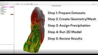
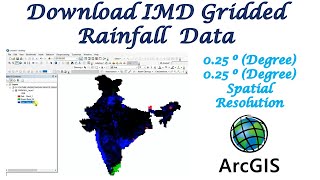
RS u0026 GIS QA21- Download Rainfall data from India-WRIS || IMD Grided Data

RS & GIS QA21 Download Rainfall data from IndiaWRIS || IMD Grided Data
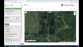
IndiaWRIS Website Link: https://indiawris.gov.in/wris/#/
Join our telegram Group Remote Sensing & GIS Professionals: https://t.me/joinchat/UhUorR2yhloKeKP...
Geotech GIS Training institute is a prestigious remote sensing training institute in India. Our vision is to bring an opportunity to every aspirant who dreams of a successful career in remote sensing and GIS field.
We conduct the following courses:
Training Program Related to Project Work Duration 1 Month
Basics of Remote Sensing and GIS Duration 3 Months
Advance Diploma in Remote Sensing and GIS Duration 6 Months
PG Diploma in Remote Sensing and GIS Duration 1 Year
Master of Remote Sensing and GIS Duration: 2 Years
Any Help Contact
Mr.Vikas [email protected]
WhatsApp Number= +918421031398
You May Like
RS & GIS QA15 Download readytouse contour lines from Open DEM & Generate DEM from Contour: • RS & GIS QA15 Download readytouse ...
Land Use Land Cover Mapping in QGIS: • Land Use Land Cove (LULC) Mapping usi...
Download Rainfall data: • Download rainfall data from CHRS Data...
Download SOI Toposheet : • New Survey of India Website to Downlo...
Google earth Playlist : • Google Earth Hands On
ArcGIS : • ARC GIS
QGIS: • QGIS Lesson
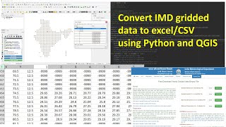
#imd #rainfall #precipitation
THANK YOU SO MUCH


![Download climate data [Rainfall, temperature, humidity] from 1981 2021](https://i.ytimg.com/vi/X56vtqutv9o/mqdefault.jpg)