Satellite Image Classification using TensorFlow in Python using CNN

!
Class Start: 8th September 2023
⏳ Admission Last Date: 6th September
Booking Last Date: 8th September (1st 10 registered people get a 50% discount. To get this discount as soon as possible complete your registration). Now only 5 seats are available to get this 50% discount. Hurry up!
Class Duration: 7 days (Friday and Saturday in Week), 3 hours each day, Time: 9:00 PM to 12:00 AM (GMT +6)
Language Mode: English
For booking your seat, contact this WhatsApp number: +8801780942798 or Email: [email protected]
Course Content:
1. Google Earth Engine: Introduction
2. JavaScript programming language A to Z
3. Google Earth Engine Server language A to Z
4. Filtering and Displaying Rater & Vector data
5. Importing Raster and Vector Data in GEE
6. Calculating with Images: Raster Calculations
7. Calculating NDVI, NDWI, EVI, & all indices.
8. Introduction to Image Classification in GEE
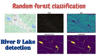
9. Landover & Land use classification Map using Machine learning
10. Crop land classification using Machine Learning
11. Exporting Raster and Vector Data from GEE
12. How to make research paper map using GEE & ArcMap software.
13. How to make a timeseries chart for NDVI, NDWI, and other Indices?
14. Spectral indices and develop the skills for calculating any index (NDVI, NDWI, NDSI, MNDWI, MSAVI)
15. How to remove CLOUD Mask from satellite Images
16. How to monitor surface water rainy and Dry time periods
17. Visualization (DEM) of Hill shade, Aspect and Slope Map
18. How to make an NDVI chart over a period of time of an Agricultural Land
19. Air Quality Monitoring: atmospheric concentrations of ozone, methane, formaldehyde, aerosol, carbon monoxide, nitrogen oxide, and sulfur dioxide
20. How to Download Air Quality parameters Time series data in CSV format using GEE
21. How to make LULC accuracy assessment using Google Earth Engine. (Kappa, Producers & Consumers accuracy)
22. Monitoring Land Surface temperature using Landsat and Modis || Make Time series chart of LST
23. How to Calculate Average, Maximum & Minimum pixel values using GEE
24. How to calculate the Classified Area using Google Earth Engine
25. How to make single class Map such as Urban maps, Water body maps, etc.
26. How to ADD A LEGEND, Title in Google Earth Engine
Online Training Benefits:
eCourse Certificate (After submitting all Assignments)
Materials (Slide, PDF)
Practice Code (All codes provided)
Recorded Class (All class recorded videos provided)
Lifetime teaching support
Don't miss this opportunity to enhance your Remote Sensing & GIS Analysis skills using Google Earth Engine. Join us now and unlock the power of geospatial data!
#GoogleEarthEngine #RemoteSensing #GISAnalysis #OnlineTraining #GeospatialData #LearnGEE