Satellite Imagery Cloud Removal and Correction In ArcGIS Pro

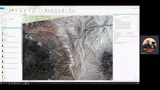
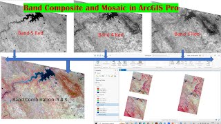
This is the newest satellite imagery cloud removal and correction tutorial I have made. The workflow described in this tutorial is similar to my previous tutorial about satellite imagery clouds removal and correction using ArcGIS Desktop. The only difference is, the workflow I described in this video is better. Because this time, we could use the QA Band as the reference cloud mask. So, it is more simple, robust, accurate, precise, and guarantees a better result. It is all thanks to Graphical Raster Functions Editor implemented in ArcGIS Pro.
Poor ArcGIS Desktop. Time to move on guys. :D
Hmm, do you still using and keep insisting to use ArcGIS Desktop??? Check this similar tutorial: • Satellite Imagery Clouds Cover Remova... .
Music by: www.bensound.com