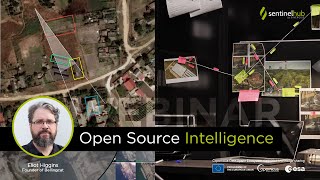
Sentinel Hub Webinar: Use of EO Data in Search and Rescue

At this live event on 27 February 2023, we hosted Ben Kuo, a technology enthusiast, rose to fame in April 2021 when he used EO data to successfully geolocate a missing hiker who had gotten lost in the Angeles Forest and send the search and rescue team to the right location so that the hiker could be brought home safely. The whole process took him less than 15 minutes. This was neither his first nor his last similar experience. With openly available tools and data, almost anyone can do it. Ben shared his experience and some funny stories to make it easier for you to do the same. For easier navigation use the following timestamps and see the relevant links.
00:00 Introduction
01:25 Ben's background
03:28 The potential for using satellite data for search and rescue
05:12 Topics
05:59 What imaging is available to us now?
09:42 An example of an ideal case of finding somebody on satellite image
11:22 Gulf Livestock 1 example
14:21 Mt. Everest as a test case for finding things
16:27 Mango Island (Tonga Eruption 2022)
18:22 Challenges and limitations
23:14 Boundary Peak Missing hiker
24:41 Satellite benchmark
26:17 Domain knowledge importance
27:30 Techniques and tips
29:10 Mysteries you can help solve (maybe?) if satellite images are available
❓ Q&A at 31:44
31:52 Have you looked at ESRI World Imagery Wayback? Good for historical comparisons.
32:12 It's mostly Maxar data, but does it use some aerial imagery?
32:48 Do you have any knowledge or experience of using EO data in SAR in the Arctic environment? Are there any best practises or limitations you can share?
34:11 Can you share more details about the missing hiker case from 2021?
38:13 What has been your experience with drone or aerial images? Where can we find good images?
39:57 Which sentinels on the EO Browser would be most useful in rescue operations in Turkey or Syria, for example?
42:06 Do these satellites only have a visual spectrum? Do you know ofany ways to use additional wavelength data to help identify subpixel features?
43:05 How much can we rely on the colours we see in optical satellite images? Depending on NADIR it seems to change and not just be darker or lighter.
44:50 Has there been any attempt to algorithmise the process so far? To find more "interesting" artefacts in satellite images?
45:39 Would automatic detection of burnt areas have helped narrow down the search for the missing hiker?
46:48 Could you explain more about the case with the ship involved?
49:13 Using the Sentinel1 data, we can still evaluate movements that occurred after an earthquake or landslide, right? Are there any fast algorithms I can use in this case?
50:38 This expertise really needs to be in the SAR and incident management teams. Do you have more requests for your help after the successful search for the missing hiker in 2021?
51:59 Do you have machine learning and deep learning scripts that you can share? Also, is it possible to classify crop types only in tropical and subtropical areas using SAR data?
Conclusion at 53:05
✍ Use our Forum for additional questions! ➡ https://forum.sentinelhub.com/
Useful links
EO Browser https://apps.sentinelhub.com/eobrow...
Commercial data in EO Browser webinar • Sentinel Hub Webinar: Commercial Data... see also • Commercial Data in EO Browser
Custom Scripts repository https://customscripts.sentinelhub.com/
Public collections repository https://collections.sentinelhub.com/
Sentinel Hub Medium blogs / sentinel
Create free Sentinel Hub trial account http://www.sentinelhub.com/create_ac...
Network of Resources sponsored Sentinel Hub accounts and access to commercial data https://www.sentinelhub.com/Network...
Useful themed links mentioned by participants
GIS of earthquake damage https://afetharita.com/
MapRoulette, a rapid crowd sourced mapping https://maproulette.org/browse/challe...
HOT Tasking Manager https://tasks.hotosm.org/
HOTOSM Turkey and Syria Earthquake Response projects https://tasks.hotosm.org/explore?camp...
"Satellite Images Map of TurkeySyria Earthquake 2023 using open data” in a storytelling https://turkey.archiving.jp/
The Indian landslide with SAR Sentinel 1 https://www.ias.ac.in/article/fulltex...
Our webinar page for links to our previous webinars and future announcements ➡ https://www.sentinelhub.com/explore/...
All webinars on our Youtube channel ➡ • Sentinel Hub Webinars