Rock YouTube channel with real views, likes and subscribers

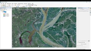
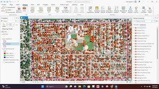
Sentinel-2 Landuse Landcover Classification Using ArcGIS pro

Sentinel2 is an Earth observation mission from the Copernicus Programme that systematically acquires optical imagery at high spatial resolution (10 m to 60 m) over land and coastal waters. and it supports a broad range of services and applications such as agricultural monitoring, emergencies management, land cover classification etc
This video details on how to carry out Land use Land cover classification using the Sentinel 2.


Recommended