Serving Rasters with Geoserver

Presenter: Cliff Patterson, PhD (CEO Luna Geospatial, Inc.)
Geoserver offers the ability to share raster data on the web using various standardized web services (e.g. WCS, WMS, etc.). In this webinar, we will introduce participants to (1) the process of optimizing different types of rasters for Geoserver, (2) adding different types of raster stores to Geoserver, and (3) sharing/consuming web services. More specifically, this webinar will discuss:
Optimizing rasters using GDAL and QGIS using best practices.
Optimizing and serving DEMs.
Serving various types of rasters, namely GeoTIFF, Geopackage mosaic, and CloudOptimized GeoTIFF (COGS).
Consuming raster data via WMS, WMTS, WCS, and TMS.
Cascading remote WMS/WMTS endpoints.
Creating group layers in Geoserver.
Caching raster layers using GeoWebCache.
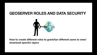
Securing raster layers in Geoserver.
For more webinars, visit https://lunageo.com/webinars