Slope Hillshade Aspect curvature u0026 elevation map From DEM in ArcGIS

Dem data anaylsis in ArcGIS.
dem data processing in arcgis.
Are you ready to dive deep into the world of Geographic Information Systems (GIS) and harness the full potential of ArcGIS? Join us on a captivating journey of discovery as we explore the intricacies of Hill Shade, Curvature, Slope, Aspect, and Elevation Map Analysis, uncovering the secrets of the terrain and elevating your GIS expertise.
In this comprehensive tutorial, we will unravel the tools and techniques that are essential for anyone working with geospatial data. Whether you're a GIS professional looking to sharpen your skills or an aspiring geographer eager to understand the landscape in greater detail, this video has something valuable to offer.
Hill Shade Analysis in ArcGIS:
Discover how to create stunning hillshade maps that bring terrain to life. We'll show you the stepbystep process of generating hillshade representations, allowing you to visualize slopes, valleys, and ridges with exceptional clarity. You'll learn how to adjust lighting angles and settings to enhance the realism of your maps. hillshade in arcgis.
Curvature Analysis in ArcGIS:
Dive into the world of curvature analysis to gain insights into surface morphology. We'll guide you through the nuances of profile curvature and plan curvature, demonstrating how these metrics can be used to identify landforms, erosion patterns, and more. Understanding curvature is a crucial aspect of geomorphological studies, and we'll make it accessible to you.
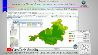
Slope Analysis in ArcGIS:
how to make slope map in arcgis?
Explore the power of slope analysis in ArcGIS. We'll walk you through the process of calculating slope values for different landscapes, helping you identify areas with steep gradients, gentle slopes, and everything in between. Whether you're studying terrain stability or planning for land development, slope analysis is a vital tool at your disposal.
Aspect Analysis in ArcGIS:
Uncover the directional characteristics of the landscape with aspect analysis. We'll show you how to determine the orientation of slopes, which is essential for understanding sun exposure, vegetation patterns, and watershed management. You'll gain the skills needed to interpret aspect maps effectively.
Elevation Map in ArcGIS:
Elevation is at the heart of GIS, and we'll guide you through various methods of analyzing elevation data. From creating contour maps to calculating elevation profiles, you'll be equipped to tackle a wide range of geospatial challenges. We'll also explore how elevation data can be integrated into other analyses for comprehensive insights.
By the end of this tutorial, you'll have a solid grasp of these fundamental GIS techniques and the confidence to apply them to realworld projects. Whether you're working in environmental science, urban planning, or simply exploring the world through maps, this video will empower you to unlock the full potential of ArcGIS.
create slope map from digital elevation model in arcgis arcgis for beginners
Don't miss out on this opportunity to elevate your GIS skills and gain a deeper understanding of the natural and built environments. Hit the play button and embark on a journey to become a proficient GIS analyst today!