15 Free YouTube subscribers for your channel

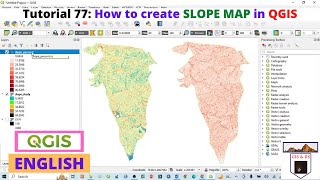
Slope Reclassification Process in QGIS

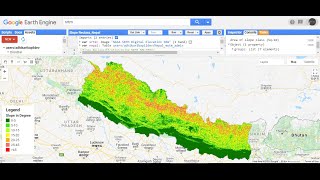
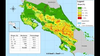
Slope maps are intended to fill in the gap regarding how steep an area is. Typically, we can measure this as either a degree value from one raster cell to the next of the Digital Elevation Models (DEMs) or DTM or as a percent/ratio.


Recommended