YouTube doesn't want you know this subscribers secret

Spatial Analysis with ArcGIS

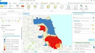
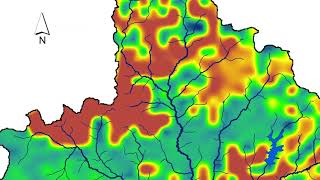
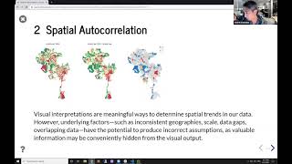
Create buffers and polygon overlays in ArcGIS, then conduct complex statistical analyses. Fundamental spatial analyses can be used to generate preliminary geographic estimates. In this case study demo, ArcGIS is used to identify which houses are in high flood risk areas and estimate the potential amount of property damage.
Learn more: http://www.esri.com/arcgis/aboutarcgis


Recommended