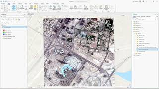
Styling Raster Data in ArcGIS Pro

In this video, you will learn about different methods of styling raster data in ArcGIS Pro software.
Styling raster data in ArcGIS Pro allows you to visually represent and enhance the interpretation of your spatial information. There are several types of styling techniques available that can be applied to raster datasets, including Stretch, Discrete, Classify, Unique Values, and Shaded Relief.
Stretch: Stretching is a common method used to enhance the contrast and distribution of pixel values in a raster. It adjusts the brightness and contrast of the image to improve its visual appearance. Stretching techniques include MinMax, Percent Clip, Standard Deviation, and Histogram Equalization.
Discrete: Discrete styling assigns unique colors or symbols to specific ranges or classes of pixel values. It is particularly useful when working with categorical or thematic raster data. You can define custom colors or symbols for each class to visually differentiate different categories in the dataset.
Classify: Classification involves grouping similar pixel values into predefined classes based on their statistical characteristics. ArcGIS Pro provides various classification methods, such as Natural Breaks (Jenks), Equal Interval, Quantile, Standard Deviation, and Manual Breaks. Each method calculates class breaks based on the distribution of pixel values, allowing you to symbolize your raster based on data distribution.
Unique Values: Unique Values styling assigns a unique color or symbol to each individual pixel value in the raster dataset. This method is useful for displaying discrete or thematic data where each pixel represents a distinct category or feature. You can manually assign colors or symbols to specific pixel values or generate them automatically.
Shaded Relief: Shaded Relief styling creates a 3Dlike effect by simulating the illumination of a light source on the raster surface. It enhances the perception of elevation and terrain features in the data. ArcGIS Pro uses algorithms to calculate the shading based on the terrain model and lighting parameters you specify, resulting in a visually appealing representation of the terrain.
These various styling techniques in ArcGIS Pro allow you to transform raw raster data into visually informative and appealing representations, aiding in better understanding and analysis of your spatial datasets.
ArcGIS Tutorials playlist • ArcGIS Pro Tutorials