A little secret to rock your YouTube subscribers

Supervised Image Classification in ArcGIS | Land Use u0026 Land Cover (LULC) Map in ArcGIS | Landsat 8-9

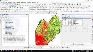
ArcGIS Supervised Classification can be used to map Land Use & Land Cover (LULC). Land use and Land cover can be easily performed by following the steps below. In order to map LULC, Landsat 8 is used. You can use Landsat 9 and follow the same process to classify.
How to Download Satellite Image: • How to Create USGS Earth Explorer Acc...
How to Band Composition and Extract AOI in ArcGIS: • How to Composite Bands and AOI Extrac...
#arcgis #gis #remotesensing #spatialanalysis


Recommended