Learn how to get Free YouTube subscribers, views and likes

SW maps Tutorial 1 Tamil

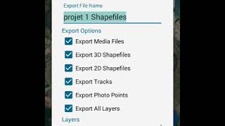
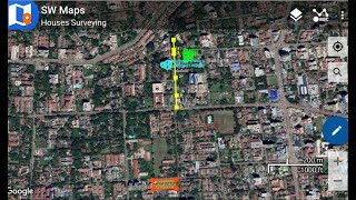
SW maps app can be used to collect the latitude longitude, geotag photos and their attributes from the field and convert into kml/kmz/csv/excel. This video is the Introduction of the SW maps and how to capture point feature


Recommended