Terrain Analysis in ArcMap | Slope Aspect Hillshade Contour from DEM Data

Terrain Analysis in ArcMap | Slope, Aspect, Hillshade, Contour from DEM Data
About this Video
Welcome to our YouTube tutorial on terrain analysis in ArcMap! In this video, we will guide you through the process of generating slope, aspect, hillshade, and contour maps from digital elevation model (DEM) data.
Terrain analysis is crucial for understanding the topography of a landscape and is widely used in various fields, including environmental science, urban planning, and geology. With ArcMap, a powerful GIS software, you can effectively analyze and visualize terrain features.
Throughout this tutorial, we will provide a stepbystep demonstration of how to generate slope, aspect, hillshade, and contour maps using DEM data in ArcMap. We will explain the underlying concepts behind each analysis technique and discuss their practical applications.
You will learn how to preprocess your DEM data, calculate slope and aspect values, create visually appealing hillshade representations, and generate contour lines that depict elevation changes across the terrain. We will also provide tips and insights to help you interpret and utilize these maps effectively.
Whether you are a GIS professional, a student, or simply interested in exploring terrain analysis in ArcMap, this tutorial is designed to equip you with the knowledge and skills to perform these essential analyses. By the end of the video, you will have a solid understanding of how to derive valuable information from DEM data using slope, aspect, hillshade, and contour maps.
So, join us on this terrain analysis journey in ArcMap, and let's unlock the potential of your DEM data together. Don't forget to like, share, and subscribe to our channel for more GIS tutorials and helpful resources. Let's dive in and master the art of terrain analysis!
#arcmap #dawnofgeospatialworld #gis #tutorial #arcgistutorial #terrain #analysis
Chapters
00:00 Intro
00:42 PreProcessing (Mosaic, Mask, Fill)
02:29 Slope
03:47 Aspect
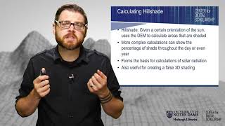
04:32 Hill Shade
05:27 Contour
07:16 Outro
Playlists ⬇
1⃣ Various Space Agencies & Missions: https://bit.ly/44UBJQI
2⃣ Data Download Processes for GIS Work: https://bit.ly/44WYP9D
3⃣ QGIS Basics Tutorials: https://bit.ly/3Oljo95
4⃣ ArcMap Basics Tutorials: https://bit.ly/3DoAopy
5⃣ Terrain Analysis: https://bit.ly/44UBJ38
6⃣ Hydrological Analysis: https://bit.ly/472LGgY
7⃣ Image Classification: https://bit.ly/3sb1iyR
The following geospatial and environmental solutions video instruction is available on this channel:
ArcGIS, QGIS (Geospatial Analysis, Monitoring)
Cartography
Basics of Mapmaking
Basics of GIS & Remote Sensing
You can watch our videos on YouTube : @dawnofgeospatialworld
If you think they're useful, kindly subscribe to our channel.
Instagram : / dogw_official
Facebook Group : / dogw.official
Thank you So Much.....


![[QGIS] RASTER TERRAIN ANALYSIS IN QGIS | SLOPE | ASPECT | HILLSHADE | RELIEF | RUGGEDNESS INDEX](https://i.ytimg.com/vi/LfKYEy0w-pc/mqdefault.jpg)