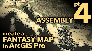
Tolkien Style Maps in a GIS: part 3 Water

“The world has changed. I see it in the water."
In this 4part series we'll walk through the reckoning of a Lord of the Rings style fantasy map, right in ArcGIS Pro. We mapmakers get to breathe honest to goodness geographic life into the seminal aesthetic found in the LOTR cartography, and I think that's a bit of magic just waiting around for us to wield.
The water of Christopher Tolkien is a charming ringed buffer fill technique used by cartographers commonly in the 18th and 19th centuries. In this howto we will walk through creating a ripple effect to fill the water bodies of Middle Earth, and add our own bit of flair by adding some dashes to the water rings and creating coastal hatching. We'll also make optional dark versions of the water.
Fantasy mapping for fun? Making custom D&D maps with read data? Mapping your municipality in an eyecatching and exciting way? Give it a go!
Here is a link to the graphical assets I made in this video if you'd prefer to use mine: https://adventuresinmapping.files.wor...
0:00 Rapturous into
0:16 Tolkien's water reference
0:50 Review of the previous symbols
1:16 Wavy scratchy rivers
2:56 Water tint
3:54 Coastal rake
5:38 Water line ripple ring things
6:54 Dark water!
7:33 Oceans
If you just can't get enough fantasy mapping, check out Wes Jones' channel, where he teaches you how to draw them from scratch: / @fantasymapping
Check out some other social channels where I share howto's and updates on random map adventures:
http://adventuresinmapping.com
https://www.esri.com/arcgisblog/auth...
/ john_m_nelson
/ johnmnelson
/ johnmnelson
Music: Venkatesananda Jesse Gallagher