Tracking 30 Year Of Water Change Detection u0026 River Course Change Analysis using Google Earth Engine

"Tracking 30 Years of Water Change Detection & River Course Change Analysis using Google Earth Engine"
Link: https://drive.google.com/file/d/1a4G...
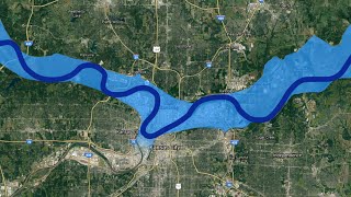
Welcome to my YouTube channel! In this video, I'll be taking you on a fascinating journey through three decades of environmental change, focusing on water bodies and the course of rivers. Using the powerful tools of Google Earth Engine, we'll dive deep into analyzing satellite imagery to track the transformation of the Indus River and detect changes in water bodies over the past 30 years.
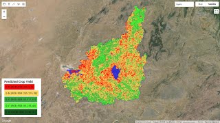
Throughout this tutorial, I'll walk you through the stepbystep process of accessing and utilizing satellite imagery datasets, filtering them to isolate the relevant data, and performing advanced analysis techniques to visualize and interpret changes in water bodies and river courses. We'll explore how to identify areas of water expansion, contraction, and even alterations in the course of the river, providing valuable insights into environmental dynamics and land use patterns over time.
But wait, there's more! To access the code used in this analysis, I've provided a link to download the code archive. However, to unlock and access the code, you'll need to watch the full video, where I'll reveal the password required to extract the code. It's a fun and interactive way to engage with the material and ensure that you're fully equipped to replicate and adapt this analysis for your own projects.
So, if you're ready to embark on this exciting journey of environmental exploration and data analysis, be sure to hit play on the video, and let's uncover the secrets hidden within the satellite imagery of the Indus River basin together!
Don't forget to like, share, and subscribe for more insightful tutorials and data analysis adventures. See you in the video!
#Tracking30Years #IndusRiverChange: "Tracking 30 Years of Change in the Indus River: Satellite Imagery Analysis"
#RemoteSensing #LandscapeChanges: "From 1990 to 2020: Analyzing 3 Decades of Landscape Changes with Remote Sensing"
#GISJourney #IndusRiverEvolution: "Indus River Over Time: A GIS Journey Through 30 Years of Data"
#IndusRiverDiscovery #SatelliteStudy: "Discovering Pakistan's Indus River Evolution: 19902020"
#LandCoverChanges #RemoteSensingStudy: "Exploring Land Cover Changes Along the Indus River: A Remote Sensing Study"
#EnvironmentalMonitoring #IndusRiverBasin: "Monitoring Environmental Changes: A 30Year Study of the Indus River Basin"
#GISAnalysis #LandUseDynamics: "GIS Analysis: Visualizing 30 Years of Land Use Dynamics in the Indus River Region"
#IndusRiverTransformation #TimeLapseAnalysis: "Unveiling the Indus River's Transformation: 19902020 TimeLapse Analysis"
#PastToPresent #SatelliteDataStory: "From Past to Present: A Story of Indus River Changes Using Satellite Data"
#IndusRiverMapping #EnvironmentalChanges: "Indus River: Mapping Environmental Changes Over Three Decades"
"Utilizing GEE with ChatGPT"
"AIDriven Analysis"
"Advanced Geospatial Analysis"
"Leveraging AI for Data Interpretation"
"AIPowered Insights"
"Harnessing the Power of AI in Environmental Studies"