Tygron Water Module: River Flood Simulation

Tygron Platform: Accelerated Simulations for Engineers
We help organizations to integrate their geospatial data and simulate, visualize and analyse scenarios. Discover how the Tygron Platform supports you in optimal decisionmaking.
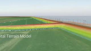
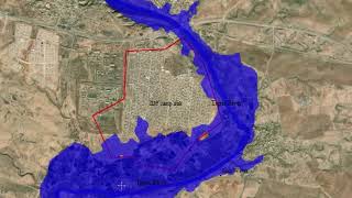
Tygron Geodesign Platform in action in this comprehensive 3D river flood simulation which allows for analyzing flow velocity and water depth at different locations. Crunching big data with our GPU supercomputer results in rapid and detailed calculations. A High Resolution gridbased model allows for a deep dive into the physical consequences of an extreme discharge for both floodplain and urban areas.
More info about the Tygron Water Module: • The Water Module
Documentation: https://support.tygron.com/wiki/Flood...
Would you like a demo? Visit our website http://www.tygron.com/