Easy way to get 15 free YouTube views, likes and subscribers

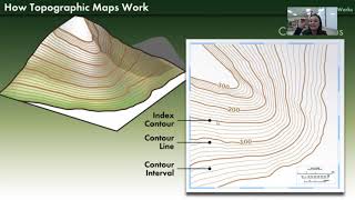
Understanding Topographic Maps

In this video we begin by looking at a topographic map of Pikes Peak in Colorado. I then build a clay model of a mountain and create cross sections representing different elevation layers. Using these layers we trace out the contour lines of the mountain to show how a three dimensional image of a landform can be mapped out on a topographic map.


Recommended