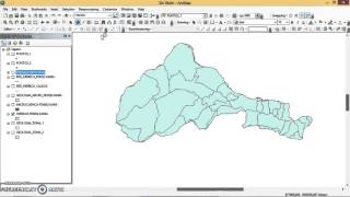
Union Tool ArcGIS

Union Tool, Overlay Toolset, Analysis Toolbox
summary
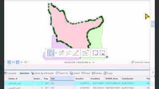
Computes a geometric union of the input features. All features and their attributes will be written to the output feature class.
Usage
All input feature classes and feature layers must have polygon geometry.
The Allow Gaps parameter can be used with the All attributes or Only feature IDs settings on the JoinAttributes parameter. This allows for identification of resulting areas that are completely enclosed by the resulting polygons. The FID attributes for these gap features will all be 1.
The output feature class will contain a FID_name attribute for each of the input feature classes. For example, if one of the input feature classes is named Soils, there will be a FID_Soils attribute on the output feature class. FID_name values will be 1 for any input feature (or any part of an input feature) that does not intersect another input feature. Attribute values for the other feature classes in the union where no intersection is detected will not be transferred to the output feature in this case.
Attribute values from the input feature classes will be copied to the output feature class. However, if the input is a layer or layers created by the Make Feature Layer tool and a field's Use Ratio Policy is checked, then a ratio of the input attribute value is calculated for the output attribute value. When Use Ratio Policy is enabled, whenever a feature in an overlay operation is split, the attributes of the resulting features are a ratio of the attribute value of the input feature. The output value is based on the ratio in which the input feature geometry was divided. For example, if the input geometry was divided equally, each new feature's attribute value is assigned onehalf of the value of the input feature's attribute value. Use Ratio Policy only applies to numeric field types.
Caution:
Geoprocessing tools do not honor geodatabase feature class or table field split policies.
This tool will use a tiling process to handle very large datasets for better performance and scalability. For more details, see Geoprocessing with large datasets.
This tool may generate multipart features in the output even if all inputs were single part. If multipart features are not desired, use the Multipart to Singlepart tool on the output feature class.
License:
With ArcGIS Desktop Basic and Desktop Standard licenses, the number of input feature classes or layers is limited to two.
union ,union tools in arcgis ,union arcgis ,geoprocessing tools ,arcgis union ,union tool ,arcgis union tool ,union tool in arcmap ,union tool arcgis pro ,geoprocessing tools in arc gis ,union arcmap ,union | arcgis ,union polygons arcgis ,union di arcgis ,union in arcmap ,union in arcgis ,where is the union tool in arcgis ,arcgis pro union ,how to use #union tool in arc #gis ,how to use union tool in gis ,union , geoprocessing tool ,mastering arcgis 10 the union tool
Explanation of the tool:
https://gisforwe.blogspot.com/2021/08...
Follow the GISforWE website here:
https://bit.ly/GISforWE
A site for anyone interested in the field of GIS from here:
https://gisforwe.blogspot.com/
Proficiency in dealing with geographic data through ArcGIS programs:
• احترف التفاعل مع البيانات من خلال برا...
Learn the basics of creating geodatabases from here:
• أساسيات بناء قواعد البيانات الجغرافية...
Here is a page and a group on Facebook to learn more about Geographic Information Systems (GIS) and ArcGIS programs through these links:
ArcGIS Facebook group:
/ 486795389231905
Facebook group GIS for WE ArcGIS:
/ esri.arcgis
GIS for WE Facebook page:
https://www.facebook.com/profile.php?...
Video link for an introduction to learning on ArcGIS programs in three stages:
• مقدمة دورة تعلم ArcGIS بثلاثة مراحل |...
#ArcGIS
#Analysis_GIS
#Data_Analysis
Prepared and presented by the developer and researcher in the field of geographic information systems, Hossam Jubeh
Ramallah Palestine.
#GISforWE
GIS for the World of ELearning