Using ArcGIS Pro to Detect Objects Using Deep Learning

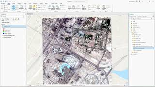
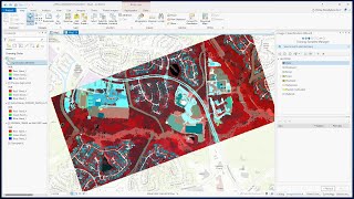
In this tutorial, you will learn how to use Equator to source an orthoimage, then use ArcGIS Pro and the tools in the Image Analyst Extension to detect and identify objects through deep learning.
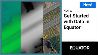
Equator has an extensive collection of the latest LiDAR and orthoimagery available, so you can download your data and get started on your project immediately. Download orthoimagery from Equator: maps.equatorstudios.com
Find this video helpful? Please like and subscribe.
Check us out on:
Website: https://equatorstudios.com/
LinkedIn: / equatorstudios
YouTube: @equatorstudios
Skills demonstrated in this video:
Equator: create site boundary, download orthoimagery
ArcGIS: import orthoimage, label objects for deep learning, image classification, create training model, detect objects through deep learning
00:00 Intro
00:18 Source Orthoimage from Equator
01:37 Open ArcGIS Pro and Import Orthoimage
02:22 Classify Objects for Deep Learning
03:16 Train Model Through Deep Learning
03:33 Use Model to Detect New Objects
05:21 That's it! Any Questions?
Have more questions or want to learn more? Check out these other videos:
Where to find LiDAR data online: • Where to find LiDAR data online? (US...
How to create 3D buildings from LiDAR in ArcGIS Pro: • ArcGIS Pro: Create 3D Buildings from ...
Create a DEM and Profile from an LAS File in ArcGIS Map: • Create a DEM and Profile from an LAS ...
Unsupervised Image Classification in QGIS: • Unsupervised Image Classification usi...
Music: Tenderness by Benjamin Tissot