The easiest way to skyrocket your YouTube subscribers

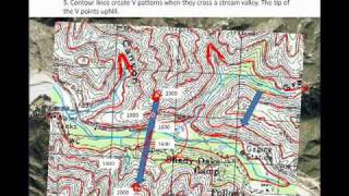
Using contours to identify landforms

Grade 11 Geography:
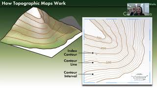
Contour lines are imaginary lines drawn on a topographic map that join places that with the same altitude. These lines show us the height, size, shape and steepness of landscape features.
Subscribe to Edukite Learning:
/ @edukitelearning
#Geography #Grade11 #topographic
#maps #contours #EdukiteLearning #edukite #SouthAfrica #CAPS #FET
#concave #slope #Convexslopes


Recommended