Viewshed analysis in QGIS 3 | visibility analysis | part-2

In this second part learn extract the area that can be visualize from multiple points based on a terrain surface using viewshed analysis in QGIS 3.
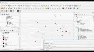
Viewshed analysis is a computational algorithm that delineates a viewshed, the area that is visible (on the base terrain surface) from a given location. It is a common part of the terrain analysis toolset found in of most geographic information system (GIS) software. The analysis uses the elevation value of each cell of the digital elevation model (DEM) to determine visibility to or from a particular cell.
This tool has varieties of application such defence, architecture planning, mobile tower location etc.
link to the part1 of viewshed analysis
• Viewshed analysis in QGIS 3 | visibil...
Tutorial to download SRTM DEM in QGIS through SRTM Downloader plugin
• Download SRTM DEM in QGIS
Tutorial to add Google Images and Maps in QGIS through HCMGIS plugin
• Google Earth Images in QGIS