Violent Tornado Animation of an EF5 Supercell (Science and Meteorology Audience Version)

Read the informal SPC Publications:
https://www.spc.noaa.gov/publications...
https://www.spc.noaa.gov/publications...
https://www.spc.noaa.gov/publications...
or
Search "Broyles" at https://www.spc.noaa.gov/publications/
Download the radar analysis / animation PowerPoint:
https://www.spc.noaa.gov/publications...
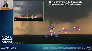
This video presents radar imagery and an animation of the full lifecycle of the Moore supercell and EF5 tornado that occurred on May 20, 2013. The radar imagery shows key features of tornadogenesis associated with the Moore tornado. It explains the processes involved in the initial tornado development, and then reveals reasons for major fluctuations of intensity during its lifetime
The animation begins 90 minutes before the tornado. The view is looking northnorthwest from a helicopter at 15,000 feet. As the Moore supercell develops, the view point gradually shifts toward the west. First, the flanking line and mesocyclone organize. Then, the first cell merger occurs. This, combined with the influence of an approaching low to midlevel jet, causes the rear flank downdraft to surge. From the cell merger, the first descending reflectivity core forms. This feature reaches the ground and hits the strengthening circulation. When this happens, the tornado immediately forms and develops from the surface upward.
As the tornado strengthens, a second set of cells approach from the southwest. When these cells merge with the Moore supercell, the second descending reflectivity core forms. This feature approaches and wraps around the tornadic mesocyclone, causing a rapid expansion of the rotation. After this, the meso snaps back and rapidly shrinks, coinciding with the first EF5 damage. The tornado alternates between EF4 and EF5 intensity, and then the low to midlevel jet passes. When this happens, the tornado jogs left, then right, and decreases in size. Soon the tornado begins to weaken and a final rear flank downdraft surge overtakes the tornado causing it to dissipate.