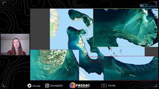
Virtual Workshop 2021: Session 5 Talk2: Bathymetry and coral/seagrass mapping in Google Earth Engine

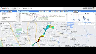
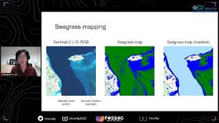
This session will showcase supervised classification of benthic habitats using the freely available Google Earth Engine: a powerful cloud computing tool to which holds a multipetabyte catalogue of satellite imagery ready for rapid analysis. We will cover how to visualise, explore, process and download data within a simple supervised classification using Sentinel 2 imagery. Training and validation data will be created to carry out an accuracy assessment and quantify the performance of the classification.
Chapters
0:00 Talk Introduction
4:33 Explore Sentinel2 data
8:11 Median Composite and masking
14:25 GEE script design
17:10 GEE Median Composite
22:03 GEE bathymetry
23:38 GEE classification
30:31 Accuracy statistics and finish
Access to Earth Engine code https://code.earthengine.google.com/?...
Download GEE Simple Classification User Guide (https://projects.noc.ac.uk/cmeprogra...)