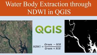
Water body Extraction from Any Satellite Image Easy Steps

#Seekshow #Subscribe #remotesensing
In this Remote sensing arcgis tutorial you will learn how to easily extract any water body from any satellite image. Arcmap software will use for this remote sensing tutorial. Watch till the end to learn additional tricks and tips for users.
In this Channel I am talking a lot about these kind of educational and technology, Tips & Tricks, Motivational, Tutorial stuff. If you interested in watching more videos make sure to subscribe to my YouTube channel.
==For More Education==
Advanced Environmental Monitoring with Remote Sensing Time Series Data and R: https://amzn.to/2AvIVuj
Imagery and GIS: Best Practices for Extracting Information from Imagery: https://amzn.to/3e8WePF
Very High Resolution (VHR) Satellite Imagery: https://amzn.to/30QwG66
Thanks For Watching
Don't Forget To Like And S U B S CR I B E for Seek Show https://bit.ly/2Ra4xCM
°°°°°°°°°°°°°°°°°°°°°°°°°°^^^^^^^^^^^^^°°°°°°°°°°°°°°°°°°°
Check Below Playlists For More Videos in My Channel ⤵
Let's Learn ArcGIS • Video
Tech Track Show • Simple trick to find hidden YouTube v...
Best Android Games • Highly addictive Android games 2017
Around Sri Lanka • Patna Deniyaya (Sri Lanka ) SlideRock...
Motivational • Motivational
°°°°°°°If you found this video valuable°°°°°°°
Hit Like
Share
Comment .
Follow Important Links & Join ‼
✅ Instagram / seek_show
✅ Twitter / seek_show
✅ Facebook / seekshowleenath
Personal Instagram / wymukthi_srilankanlifenotes
✅ For Sponsorships & Offers [email protected]
Register for any professional work (Graphics and Design, Digital Marketing, Video Animation, Writing Translation, Programming Tec, Business, Life Style & get up to 100$ http://www.fiverr.com/s2/ceccb2c3c3
Contact me here if you need my ArcGIS Mapping Services
,
1. To Design Professional Maps For You Data https://www.fiverr.com/leenathwymkthi...
2. To Do Any Custom Gis Work Accurately https://www.fiverr.com/leenathwymkthi...
3. To Create Professional Maps For Your Data https://www.fiverr.com/leenathwymkthi...
4. To Design Professional Gis Maps For You https://www.fiverr.com/leenathwymkthi...