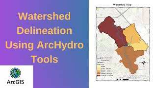
watershed delineation using Arc Hydro in Arcgis 10.5
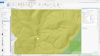
Fill Sinks: The Fill Sinks function (DEM Manipulation menu) fills sinks in a grid. If a cell is surrounded by higher elevation cells, the water is trapped in that cell and cannot flow. The Fill Sinks function modifies the elevation value to eliminate these problems. In most cases, when depressions are the artefacts of DEM generation, this is a correct assumption
2 Flow Direction: The Flow Direction function takes a grid as input, and computes the corresponding flow direction grid ("Flow Direction Grid" tag). The values in the cells of the flow direction grid indicate the direction of the steepest descent from that cell.
3 Flow Accumulation: The Flow Accumulation function takes as input a flow direction grid. It computes the associated flow accumulation grid ("Flow Accumulation Grid" tag) that contains the accumulated number of cells upstream of a cell, for each cell in the input grid.
4 Stream Definition: The Stream Definition function takes a flow accumulation grid as input and creates a Stream Grid ("Stream Grid" tag) for a userdefined threshold. This threshold is defined either as a number of cells (default 1%) or as a drainage area in square kilometres.
5 Stream Segmentation: The Stream Segmentation function creates a grid of stream segments that have a unique identification. Either a segment may be a head segment, or it may be defined as a segment between two segment junctions. All the cells in a particular segment have the same grid code that is specific to that segment. The input Sink Watershed grid is optional and may be used to specify the areas located within sink drainage areas, where the stream links should not be generated.
6 Catchment grid delineation: The Catchment Grid Delineation function (creates a grid in which each cell carries a value (grid code) indicating to which catchment the cell belongs. The value corresponds to the value carried by the stream segment that drains that area, defined in the input Link grid.
7 Catchment polygon processing: The Catchment Polygon Processing takes as input a catchment grid and converts it into a catchment polygon feature class ("Catchment" tag). The adjacent cells in the grid that have the same grid code are combined into a single area, whose boundary is vectorized. The single cell polygons and the "orphan" polygons generated as the artefacts of the vectorization process are dissolved automatically, so that at the end of the process there is just one polygon per catchment.
8 Drainage line processing: The Drainage Line Processing function converts the input Stream Link grid into a Drainage Line feature class. Each line in the feature class carries the identifier of the catchment in which it resides.
9 Adjoint catchment processing: The Adjoint Catchment Processing function generates the aggregated upstream catchments from the "Catchment" feature class. For each catchment that is not a head catchment, a polygon representing the whole upstream area draining to its inlet point is constructed and stored in a feature class that has an "Adjoint Catchment" tag. This feature class is used to speed up the point delineation process.
To see more videos visit website : http://mondegeospatial.com/


![The moment we stopped understanding AI [AlexNet]](https://i.ytimg.com/vi/UZDiGooFs54/mqdefault.jpg)