Watershed Delineation Using ArcGIS Pro | Step-by-Step Tutorial

Dive into the world of hydrology and geospatial analysis with our comprehensive tutorial on River and Watershed Delineation using ArcGIS Pro! Whether you're a GIS enthusiast, environmental scientist, or a student eager to enhance your skills, this stepbystep guide will empower you to efficiently delineate rivers and watersheds.
In this tutorial, we'll focus on leveraging the powerful tools in ArcGIS Pro to:
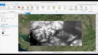
1⃣ Prepare Data: Learn how to import and organize the necessary data, including digital elevation models (DEMs) and hydrography datasets, to set the stage for accurate delineation.
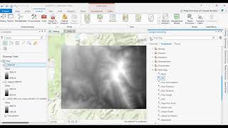
2⃣ Terrain Analysis: Uncover the secrets of terrain analysis as we guide you through the essential steps to identify flow directions and delineate the river network.
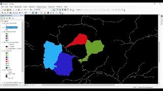
3⃣ Watershed Delineation: Witness the magic unfold as we demonstrate the precise techniques for delineating watersheds based on your chosen pour points.
4⃣ Data Visualization: Explore effective ways to visualize your results, creating stunning maps that convey meaningful information about the river and watershed morphology.
Whether you're working on environmental impact assessments, water resource management, or just satisfying your curiosity about the world around you, this tutorial will equip you with the skills to make informed decisions through geospatial analysis.
Ready to elevate your GIS game? Hit play now and embark on a journey to master River and Watershed Delineation using ArcGIS Pro! Don't forget to like, subscribe, and hit the notification bell to stay updated on our latest geospatial tutorials.
Join Membership to get access to perks & Support us
/ @terraspatial
Useful Links:
Downloading 30m SRTM DEM data from USGS EarthExplorer
• Downloading 30m SRTM DEM data from US...
Flow direction raster details
https://pro.arcgis.com/en/proapp/lat...
Flow accumulation raster details
https://pro.arcgis.com/en/proapp/lat...
Join the Terra Spatial Community:
Engage with fellow learners, share your experiences, and get support on our dedicated community forum.
Stay connected:
Subscribe to our Channel: / @terraspatial. .
Facebook: / terraspatial
Geosuite blog: https://geosuite.blogspot.com/
**Don't forget to Like, Share, and Subscribe for more insightful tutorials! ✨
#arcgispro #geospatialanalysis #RiverDelineation #WatershedAnalysis #gistutorial #spatialanalysis #LearnGIS #DataScience #mappingskills