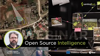
Webinar: Automated Agricultural Field Delineation Tool

The automatic agricultural field delineation tool was developed as part of the NIVA H2020 project. This webinar took place on March 3rd 2022. It focuses on use cases, specifically how you can leverage Sentinel Hub and machine learning to develop modern agriculture monitoring applications.
0:00 Introduction & 1:00 Agenda
1:54 What is the delineation tool and how can it help you
3:45 Overview of the technical components
4:51 Main steps (6:10 Data download, 7:57 Preparing EOPatches, 10:07 Sampling, 11:56 Conversion to trainingready format, 13:11 Normalization, 14:55 Split into KFolds, 15:55 Model & Training, 17:53 Prediction, 18:55 Post processing, 21:12 Vectorization)
23:57 Handson demonstration of how the tool works
37:35 Discussion on possible future improvements
39:51 Q&A
40:07 What's the exact name of the cloud detection algorithm?
40:26 What is the minimum parcel's area that can be detected?
41:36 If you download data for the whole season and sample from the EOPatches, some images of the EOPatch have clouds others not. How do you sample a particular EOPatch?
42:55 Is it also possible to use other datasources like aerial images or VHR data with the same tooling?
43:53 With that Kfolds design, what's the minimum number of EOpatches needed? This could make if difficult to train a model on a small area.
45:16 How well would this methodology work in a smallholder farming settings, e.g. in SubSaharan Africa?
47:26 Could you explain more about avoiding border effects? What is that function for the overlap area? (Simon)
48:19 How generalisable is this? If I train on mainland Europe and then run over the UK should I expect accurate field boundaries? + Could you tell us more about transfer learning, temporally and spatially?
50:56 Do you have the code in R language?
51:04 How can we request access to GSAA data? On a countrybycountry basis?
51:52 Is it possible to download the data not using the Sentinel Hub batch API but the exploration and basic API?
53:02 Can we tweak the model around data storage, meaning using other cloud storage instead of AWS?
53:50 Will the field delineation be available as a Library or API call with your trained model? Meaning, can I get the field delimitations for an image in a bounding box calling a Library or API?
54:54 After training and testing the model, how could we use it to predict new Sentinel2 images?
55:45 Do you have any accuracy figures for your boundary detection results? How about tramlines being misclassified as boundaries? Can we have access to your trained Deep Learning model?
57:28 Is better use that customize NN instead pretraining NN models?
58:56 What is your experience with heterogeneous fields?
1:00:06 Will the vectorized polygon be with holes?
1:00:40 Is there any size for the boundaries to download data for AOI? How do you merge more scenes using Sentinel Hub?
1:01:44 What level of the Sentinel2 images are used, L2A or L1C?
1:02:05 Are there any pretrained models available?
1:02:42 Are you ignoring cloudy pixels when computing the loss function?
1:03:10 Most of the time, user encounters features likes trees, water channels, etc. along the edges and inside the farm. These features can impact the model training and performance. What approach can be used to overcome it?
1:04:19 Did you apply any data augmentation technique such as Dihedral or Color Jitter?
1:04:43 What is the importance of distance mask in the delineation task?
1:05:13 Is processing occurring on AWS or a local machine? How can one save download data and products locally to avoid paying for AWS?
1:06:00 From this detection one can detect really field delineation or active vegetation boundaries? If it is one of the two is the other one option possible?
1:08:15 Could we assess crop water productively for a specific crop after we delineate the specific area?
1:09:26 In your experience, what are the challenges that still remain in field boundary delineation task using the EO data?
1:11:22 Did you apply any stratification based on parcel's dimensions to balance different types of parcels?
1:12:01 What is the accuracy of your model?
1:12:23 There is a possibility of a connection between neighbouring farms, are you using any algorithm in postprocessing to disconnect them?
1:14:21 Do you plan to provide free subscriptions for students/researchers?
1:15:01 Conclusion
Useful links
Automatic Field Delineation Tool: https://github.com/sentinelhub/field...
eolearn: https://github.com/sentinelhub/eolearn
eoflow: https://github.com/sentinelhub/eoflow
Create Sentinel Hub Trial Account: https://www.sentinelhub.com/create_a...
Apply for ESA Sponsored Account: https://www.sentinelhub.com/Network...
Blog post: / parcelboundarydetectionforcap
Contact us
✍ Email: [email protected]
✍ GitHub Issues: https://github.com/sentinelhub/field...
✍ Forum:https://forum.sentinelhub.com/