What Is GIS? A Guide to Geographic Information Systems

What is GIS? https://gisgeography.com/whatisgis/
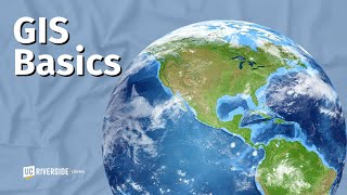
GIS stands for Geographic Information Systems. It's a computerbased tool that examines spatial relationships, patterns, and trends in geography. Using a GIS allows you to store, analyze, and visualize data for geographic positions on Earth’s surface.
There are 4 main functions of a GIS:
1) First, a GIS has a data management component for storing geographic locations.
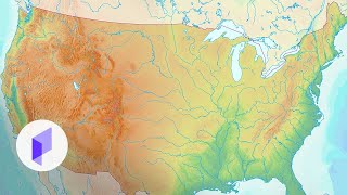
2) Secondly, a GIS visualizes geographic data typically using maps.
3) Thirdly, GIS software can analyze spatial relationships and patterns using geoprocessing.
4) And finally, a GIS can either create new data or edit existing data.
Watch this video to learn more about "What Is GIS" and how we use GIS to model the world around us.