What is GIS and What is GPS Basics || Geographical Information System and Global Positioning System

GIS (Geographic Information System) and GPS (Global Positioning System) are two related but distinct technologies that are often used together in various applications.
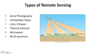
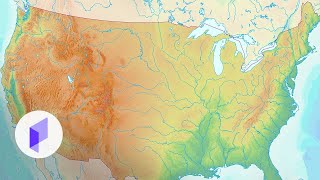
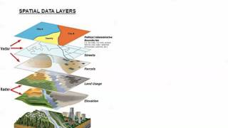
GIS (Geographic Information System): GIS is a computerbased system designed to capture, store, analyze, manage, and present spatial or geographical data. It combines various layers of information, such as maps, satellite imagery, aerial photography, and other geographic data, along with associated attributes like population, land use, infrastructure, etc. The core concept of GIS is to link data to its specific location on the Earth's surface, allowing users to gain valuable insights and make informed decisions based on spatial patterns and relationships.
GPS (Global Positioning System): GPS is a satellitebased navigation system that provides accurate positioning, timing, and velocity information for users with GPS receivers. It was developed and is maintained by the United States government. The system comprises a constellation of satellites that orbit the Earth and continuously transmit signals that are received by GPS receivers on the ground. By calculating the time it takes for signals to reach multiple satellites, a GPS receiver can determine its precise location on Earth.
GIS deals with the management and analysis of spatial data, while GPS is a technology used to determine precise location information on Earth. When combined, GIS and GPS enable powerful applications for mapping, navigation, analysis, and decisionmaking in a wide range of fields.
Subscribe @bestsolutionline