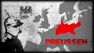
What Was Prussia?

In this video, we look at Prussia, and explain what exactly it was, and how it fit into history.
Check us out here too!
Patreon: www.Patreon.com/Fireoflearning
Facebook: / fireoflearning140814776119638
Instagram: @Fire_of_Learning
Twitter: @Fire_Learning
Picture sources:
By User:52 Pickup Based on map data of the IEGMaps project (Andreas Kunz, B. Johnen and Joachim Robert Moeschl: University of Mainz) — http://www.iegmaps.unimainz.de, CC BYSA 2.5, https://commons.wikimedia.org/w/index...
By MapMaster Own work based on: a map by Marija Gimbutas, published in The Balts (1963) LCC 63018018. Available at Vaidilute.com. In addition to Gimbutas, other maps were also consulted:"Libiesi Citu Senas Latvijas Cilsu Vidu" (Livonians and other tribes of ancient Latvia 10th 12th centuries) A map from the Latvijas Enciklopedja[dead link]Map at Emokykla.LTAnother map at Emokykla.LT, CC BYSA 3.0, https://commons.wikimedia.org/w/index...
By Ivo Kruusamägi Own work, CC BYSA 3.0 ee, https://commons.wikimedia.org/w/index...
By Артур Орльонов http://www.historyua.org/gallery/sho..., CC BYSA 3.0, https://commons.wikimedia.org/w/index...
CC BYSA 3.0, https://commons.wikimedia.org/w/index...
By Sir IainThis W3Cunspecified vector image was created with Inkscape. Main source:"Deutschland: 16181648", in: Josef Engel (ed.), Grosser Historischer Weltatlas, herausgegeben vom Bayerischen SchulbuchVerlag: Dritter Teil, Neuzeit, Munich and Tübingen, 1967, p. 122.Other sources:"HessenKassel und HessenDarmstadt 16041638", in: Geschichtlicher Atlas von Hessen, url: http://www.lagishessen.de/de/subject..."HessenKassel in Nordwestdeutschland", in: Geschichtlicher Atlas von Hessen, url: http://www.lagishessen.de/de/subject..."BraunsweichLüneburg im Jahre 1625", in: Gudrun Pischke (ed.), Geschichtlicher Handatlas von Niedersachsen, Neumünster, 1989, p. 35b.Carsten Porskorg Rasmussen (ed.), Die Fürsten des Landes: Herzöge und Grafen von Schleswig, Holstein und Lauenburg, Neumünster, 2008, p. 21., CC BYSA 4.0, https://commons.wikimedia.org/w/index...
By ziegelbrenner (talk • contribs) Own work, source of Information: Putzger – Historischer Weltatlas, 89. Auflage, 1965, CC BY 2.5, https://commons.wikimedia.org/w/index...
By Bryan Rutherford Own work, based on File:Europe 17481766 en.png, CC BYSA 4.0, https://commons.wikimedia.org/w/index...
By ziegelbrenner own drawing/Source of Information: Putzger – Historischer Weltatlas, 89. Auflage, 1965; Westermanns Großer Atlas zur Weltgeschichte, 1969; Haacks geographischer Atlas. VEB Hermann Haack GeographischKartographische Anstalt, Gotha/Leipzig, 1. Auflage, 1979., CC BY 2.5, https://commons.wikimedia.org/w/index...
By ziegelbrenner, CC BYSA 3.0, https://commons.wikimedia.org/w/index...
By ziegelbrenner own drawing/Source of Information: Putzger – Historischer Weltatlas, 89. Auflage, 1965, CC BYSA 3.0, https://commons.wikimedia.org/w/index...