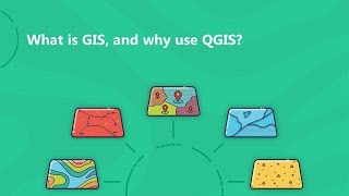
Why QGIS? Quantum GIS (QGIS) is a powerful geographic information system software package.

Welcome to this video where we explore why QGIS is the preferred choice for spatial analysis and map cartography. In this informative session, we dive into the reasons why QGIS stands out as a powerful tool in the world of geographic information systems.
Throughout the video, we'll highlight the key features and advantages that make QGIS an exceptional option for spatial analysis. From its extensive range of spatial analysis tools to its customization and extensibility capabilities, you'll discover how QGIS empowers users to perform complex analyses, manipulate spatial data, and gain valuable insights from geographic information.
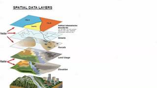
One of the standout strengths of QGIS is its wide format support, enabling seamless integration with various GIS data sources. We'll explore the compatibility of QGIS with popular formats such as Shapefile, GeoJSON, KML, and more, enhancing interoperability and enabling users to work with diverse data types effortlessly.
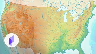
Map cartography is another area where QGIS excels. We'll delve into the impressive array of tools and options available for designing visually stunning maps. From styling and symbolization to advanced labeling techniques and thematic mapping, you'll witness how QGIS empowers users to create professionalquality maps that effectively communicate spatial information.
Additionally, we'll discuss the integration capabilities of QGIS with other GIS platforms, allowing for seamless collaboration and data exchange with users of different systems. You'll learn about its compatibility with commercial software like ArcGIS, opening doors for enhanced cooperation and interoperability.
The active community surrounding QGIS is another highlight we'll touch upon. We'll emphasize the wealth of support, regular updates, and valuable resources available, including documentation, tutorials, and forums. This vibrant community fosters knowledge sharing, collaboration, and continuous development.
Join us in this engaging video to understand why QGIS has gained popularity among individuals, organizations, and researchers working with geospatial data. Discover the reasons behind its preference as we showcase the remarkable capabilities that make QGIS an indispensable tool for spatial analysis and map cartography.
Don't miss out on the opportunity to unlock the full potential of QGIS and elevate your spatial analysis and map creation skills. Hit the play button now and embark on this enlightening journey into the world of QGIS!