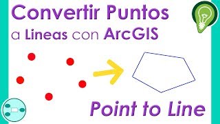
XY To Line Tool ArcGIS

Xy to Line Tools in ArcGIS Pro:
• 45. XY to Line Tool in ArcGIS Pro | A...
XY To Line Tool, Features Toolset, Data Management
ArcToolbox
summary
Creates a new feature class containing geodetic line features constructed based on the values in a start xcoordinate field, start ycoordinate field, end xcoordinate field, and end ycoordinate field of a table.
Usage
If you use text files and .csv files as input, make sure they follow the file structure specified in Tabular data sources.
Each geodetic line is constructed using a particular set of field values representing the x and y coordinates of a starting point and the x and y coordinates of an ending point. These fields and values will be included in the output.
A geodetic line is a curve on the surface of the earth. However, a geodetic line feature is not stored as a parametric (true) curve in the output; rather, it is stored as a densified polyline representing the path of the geodetic line. If the length of a geodetic line is relatively short, it may be represented by a straight line in the output. As the length of the line increases, more vertices are used to represent the path.
When the output is a feature class in a file geodatabase or a personal geodatabase, the values in the Shape_Length field are always in the units of the output coordinate system specified by the Spatial Reference parameter, and they are the planar lengths of the polylines. To measure a geodesic length or distance, use the ArcMap Measure tool and choose the Geodesic, Loxodrome, or Great Elliptic option accordingly before taking a measurement.
arcgis tools ,points to lines ,tools ,lines ,flow lines ,military tools for arcgis ,hawths tools ,military tools ,table select tools ,arcgis xy to line ,xy to line arcgis ,select tool arcgis online ,xy to line ,x y to line ,polyline z ,arctoolbox ,arc toolbox ,xy to line map ,point to line ,points to line ,arcgis online ,arcgis toolbox ,arcgis toolbar ,make points to line in arcgis ,line ,create xy to line map in arcmap ,point to line in gis ,arcmap select tool
Explanation of the tool:
https://gisforwe.blogspot.com/2021/10...
Follow the GISforWE website here:
https://bit.ly/GISforWE
Lifetime download of ArcGIS and ArcGIS Pro software:
https://gisforwe.blogspot.com/2022/11...
https://gisforwe.blogspot.com/2021/05...
A site for anyone interested in the field of GIS from here:
https://exe.io/GISforWE
Proficiency in dealing with geographic data through ArcGIS programs:
https://exe.io/GISforWE1
Learn the basics of creating geodatabases from here:
https://exe.io/GISforWE2
Here is a page and a group on Facebook to learn more about Geographic Information Systems (GIS) and ArcGIS programs through these links:
ArcGIS Facebook group:
/ 486795389231905
Facebook group GIS for WE ArcGIS:
/ esri.arcgis
GIS for WE Facebook page:
https://www.facebook.com/profile.php?...
Video link for an introduction to learning on ArcGIS programs in three stages:
https://exe.io/GISforWE3
#ArcGIS
#Analysis_GIS
#Data_Analysis
Prepared and presented by the developer and researcher in the field of geographic information systems, Hossam Jubeh
Ramallah Palestine.
#GISforWE
GIS for the World of ELearning


![How to create Point, Line & Polygon from Excel (.CSV) Table in ArcGIS Pro [Khmer GIS Academy]](https://i.ytimg.com/vi/OhflPT6YKUs/mqdefault.jpg)